


WATER, Ottawa County, Ohio
About
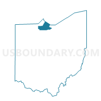
Outline

Summary
| Unique Area Identifier | 650859 |
| Name | WATER |
| County | Ottawa County |
| State | Ohio |
| Area (square miles) | 317.88 |
| Land Area (square miles) | 0.00 |
| Water Area (square miles) | 317.87 |
| % of Land Area | 0.00 |
| % of Water Area | 100.00 |
| Latitude of the Internal Point | 41.51796580 |
| Longtitude of the Internal Point | -82.94305170 |
Maps


Graphs
Select a template below for downloading or customizing gragh for WATER, Ottawa County, Ohio


Neighbors
Neighoring Voting District (by Name) Neighboring Voting District on the Map
- 003 PORT CLINTON 2A, Ottawa County, OH
- 005 PORT CLINTON 3A, Ottawa County, OH
- 007 PORT CLINTON 4A, Ottawa County, OH
- 013 BAY 1, Ottawa County, OH
- 018 CARROLL 2, Ottawa County, OH
- 019 CATAWBA ISLAND 1, Ottawa County, OH
- 020 CATAWBA ISLAND 2, Ottawa County, OH
- 021 CATAWBA ISLAND 3, Ottawa County, OH
- 022 CATAWBA ISLAND 4, Ottawa County, OH
- 027 DANBURY 1, Ottawa County, OH
- 028 DANBURY 2, Ottawa County, OH
- 029 DANBURY 3, Ottawa County, OH
- 030 DANBURY 4, Ottawa County, OH
- 031 DANBURY 5, Ottawa County, OH
- 032 ERIE 1, Ottawa County, OH
- 037 PORTAGE 1, Ottawa County, OH
- 038 PORTAGE 2, Ottawa County, OH
- 039 MIDDLE BASS, Ottawa County, OH
- 039 North Bass, Ottawa County, OH
- 039 PUT-IN-BAY 1, Ottawa County, OH
- 039 PUT-IN-BAY TOWNSHIP, Ottawa County, OH
- Voting District 143999, Sandusky County, OH
- JERUSALEM 2 Voting District, Lucas County, OH
- PRECINCT KI VILL, Erie County, OH
- PRECINCT SAN M, Erie County, OH
- WATER, Erie County, OH
- Water, Lucas County, OH
Top 10 Neighboring County Subdivision (by Population) Neighboring County Subdivision on the Map
- Sandusky city, Erie County, OH (25,793)
- Port Clinton city, Ottawa County, OH (6,056)
- Margaretta township, Erie County, OH (5,981)
- Danbury township, Ottawa County, OH (5,167)
- Catawba Island township, Ottawa County, OH (3,599)
- Jerusalem township, Lucas County, OH (3,109)
- Carroll township, Ottawa County, OH (2,135)
- Bay township, Ottawa County, OH (1,458)
- Portage township, Ottawa County, OH (1,291)
- Riley township, Sandusky County, OH (1,226)
Top 10 Neighboring Place (by Population) Neighboring Place on the Map
- Sandusky city, OH (25,793)
- Port Clinton city, OH (6,056)
- Marblehead village, OH (903)
- Lakeside CDP, OH (694)
- Put-in-Bay village, OH (138)
Top 10 Neighboring Unified School District (by Population) Neighboring Unified School District on the Map
- Oregon City School District, OH (23,523)
- Port Clinton City School District, OH (13,596)
- Benton-Carroll-Salem Local School District, OH (10,225)
- Danbury Local School District, OH (5,178)
- Put-in-Bay Local School District, OH (608)
- School District Not Defined, OH (59)
- Middle Bass Local School District, OH (25)
- School District Not Defined (Water), OH (4)
- North Bass Local School District, OH (0)
Top 10 Neighboring State Legislative District Lower Chamber (by Population) Neighboring State Legislative District Lower Chamber on the Map
- State House District 81, OH (116,551)
- State House District 80, OH (110,118)
- State House District 49, OH (107,325)
- State House Districts not defined, OH (0)
Top 10 Neighboring State Legislative District Upper Chamber (by Population) Neighboring State Legislative District Upper Chamber on the Map
- State Senate District 2, OH (363,296)
- State Senate District 26, OH (347,609)
- State Senate District 11, OH (314,125)
- State Senate Districts not defined, OH (0)
Top 10 Neighboring 111th Congressional District (by Population) Neighboring 111th Congressional District on the Map
Top 10 Neighboring Census Tract (by Population) Neighboring Census Tract on the Map
- Census Tract 417, Erie County, OH (6,612)
- Census Tract 408, Erie County, OH (4,398)
- Census Tract 508, Ottawa County, OH (4,056)
- Census Tract 9608, Sandusky County, OH (3,604)
- Census Tract 512, Ottawa County, OH (3,520)
- Census Tract 409, Erie County, OH (3,299)
- Census Tract 506, Ottawa County, OH (3,293)
- Census Tract 505, Ottawa County, OH (3,213)
- Census Tract 97, Lucas County, OH (3,100)
- Census Tract 503.01, Ottawa County, OH (2,867)
Top 10 Neighboring 5-Digit ZIP Code Tabulation Area (by Population) Neighboring 5-Digit ZIP Code Tabulation Area on the Map
- 44870, OH (41,030)
- 43452, OH (13,811)
- 43449, OH (8,278)
- 43440, OH (4,875)
- 43464, OH (1,460)
- 43445, OH (1,161)
- 43456, OH (608)
- 43446, OH (25)